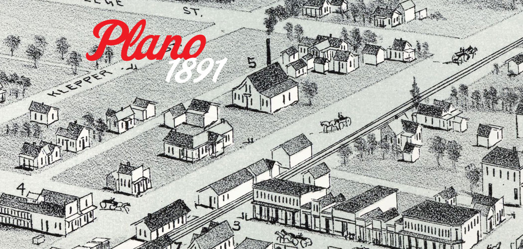
The first non-native settlers to Plano came from Kentucky and Tennessee beginning in the early 1840s. Plano was incorporated as a city in 1873 and elected its first Mayor. When renowned cartographer Thaddeus Mortimer Fowler created this bird’s eye view of Plano in 1891, the city’s population was between 1,200-1,500. As of January 2015, Plano’s population was approximately 270,000.
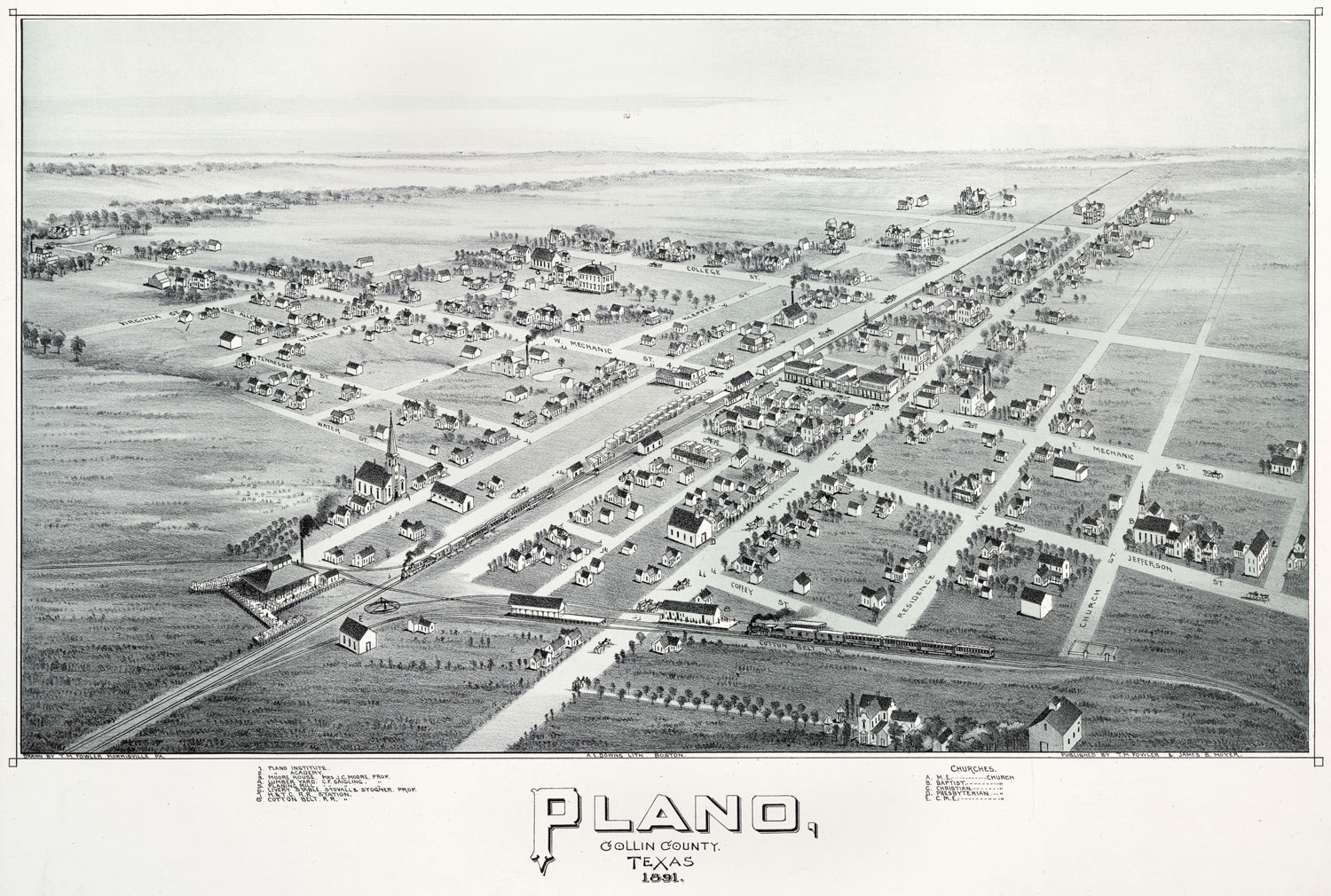
Below, portions of T. M. Fowler’s map are enlarged and numbered so that you may get a better view of the city’s business center in 1891. Although the visual character of the city has changed much in the past 125 years, Plano is still considered by many to be one of the best places to live in the US. We couldn’t agree more.
(Modern-day street names have been added in blue.)
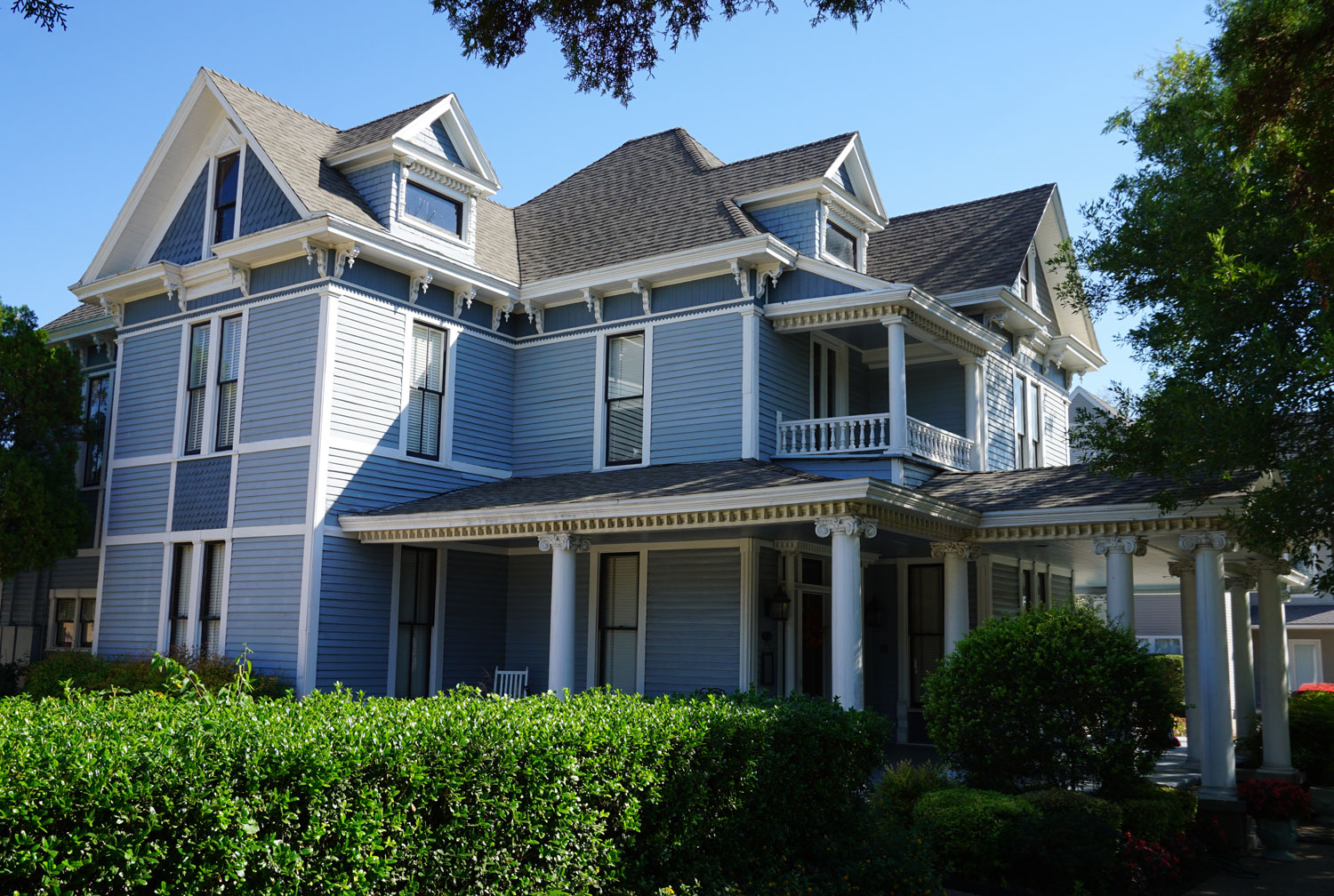
1. Olney Davis House
Built circa 1890, this was originally the home of Olney Davis, first President of Plano School Board and Plano Mayor for two terms. Davis Elementary is also named in his honor. Currently the home is headquarters for City House Youth Resource Center and before that, ArtCentre of Plano.
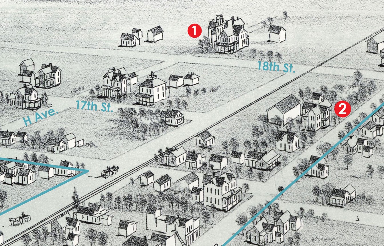
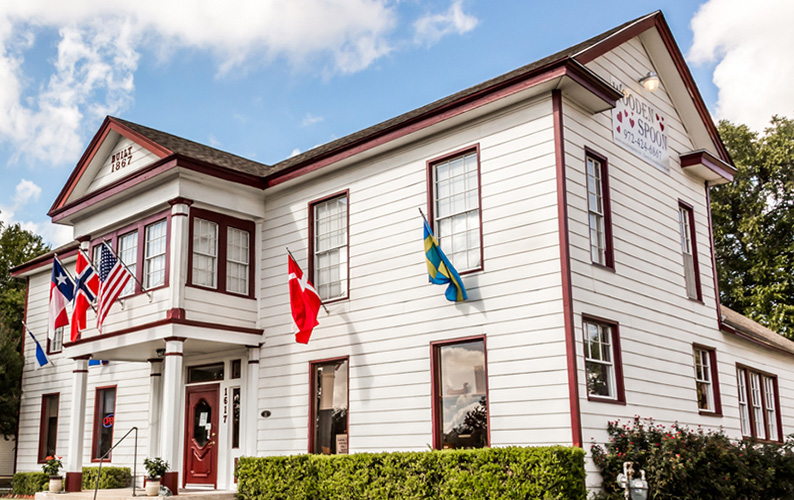
2. Joseph Forman House
William Forman was patriarch of one of Plano’s founding families and the city’s first postmaster. His son Joseph Forman built this home in 1867. The home now houses The Wooden Spoon Scandinavian gift shop.
3. First Christian Church
The building shown here was erected in 1873 at the southwest corner of present-day 16th Street and G Avenue. The Haggard, Carpenter and Bush families were among the early organizers of this church and also early advisors and investors in Add-Ran College, which later became Texas Christian University (TCU). The present-day building of First Christian Church stands near this spot today at the intersection of 15th Street and H Avenue, just across from Haggard Park.
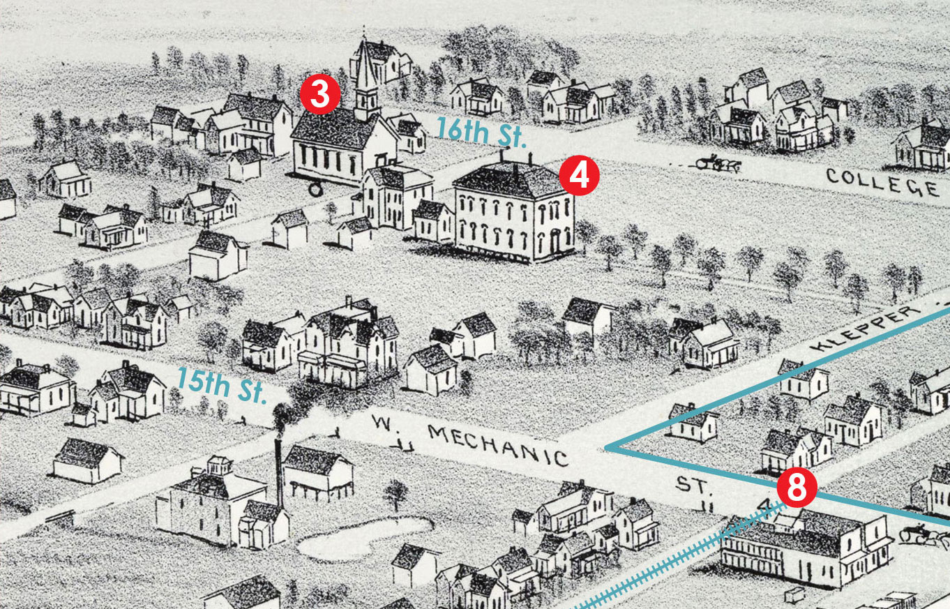
4. Plano Institute
Opened in 1882 by W.F. Mister and T.G. Harris, this important private school was sold to the city in 1891 to become Plano’s first public school. It stood near the southeast corner of 16th Street and G Avenue (which is now the parking lot for the Courtyard Theatre and Cox Building).
5. Downtown Plano
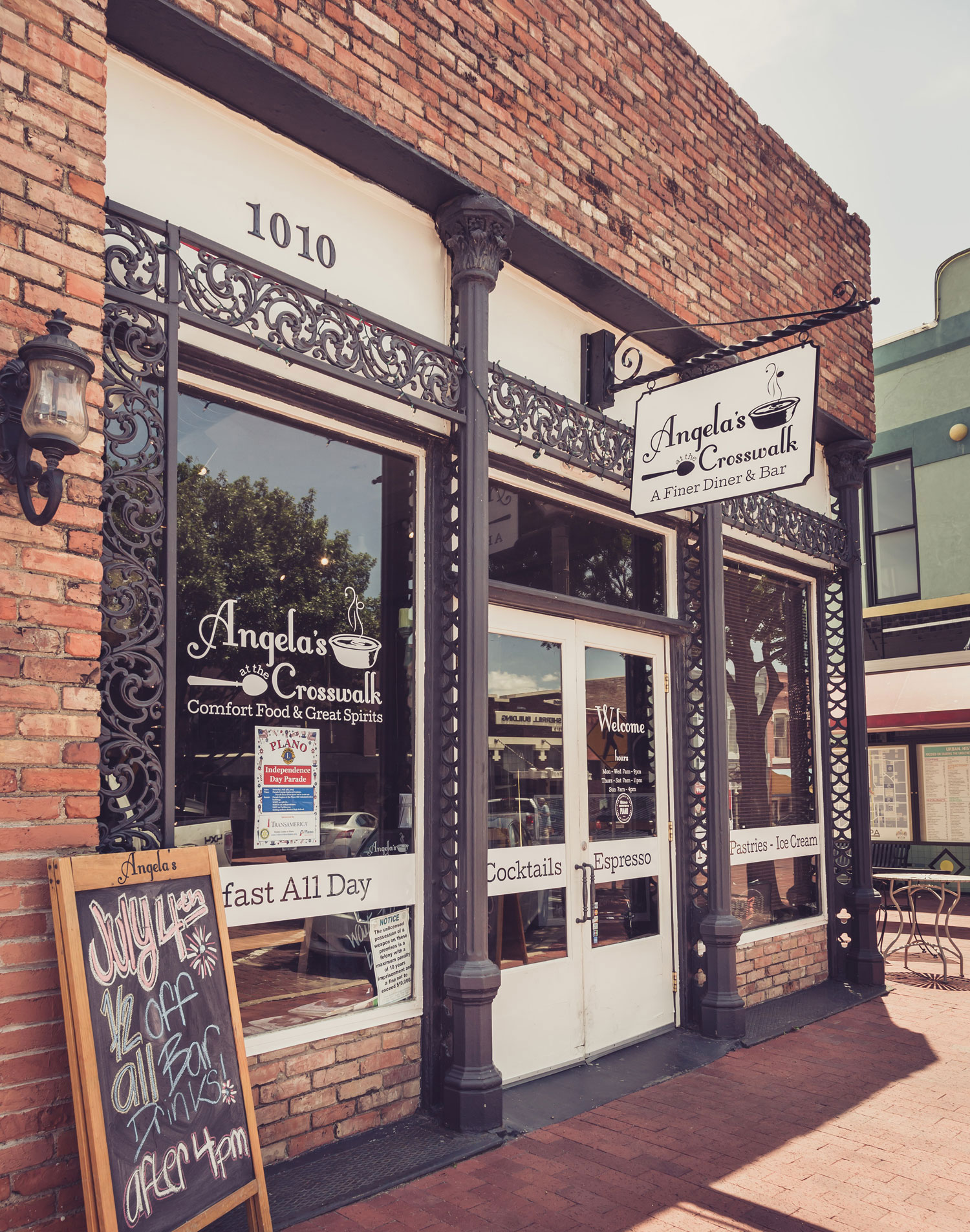
The area along Mechanic Street (now 15th Street) near the H&TC Railroad (now DART) was the primary center of business activity in 1891. At that time, Plano boasted drugstores, physicians, lawyers, hardware stores, blacksmiths, saloons, grocers, restaurants, and even a dentist, a toy shop, a photography studio and a hotel, among many others. The Great Fire of 1895 destroyed most of the business district. Many sources believe the only downtown building from this map that still stands is 1010 East 15th (currently Angela’s at the Crosswalk restaurant).
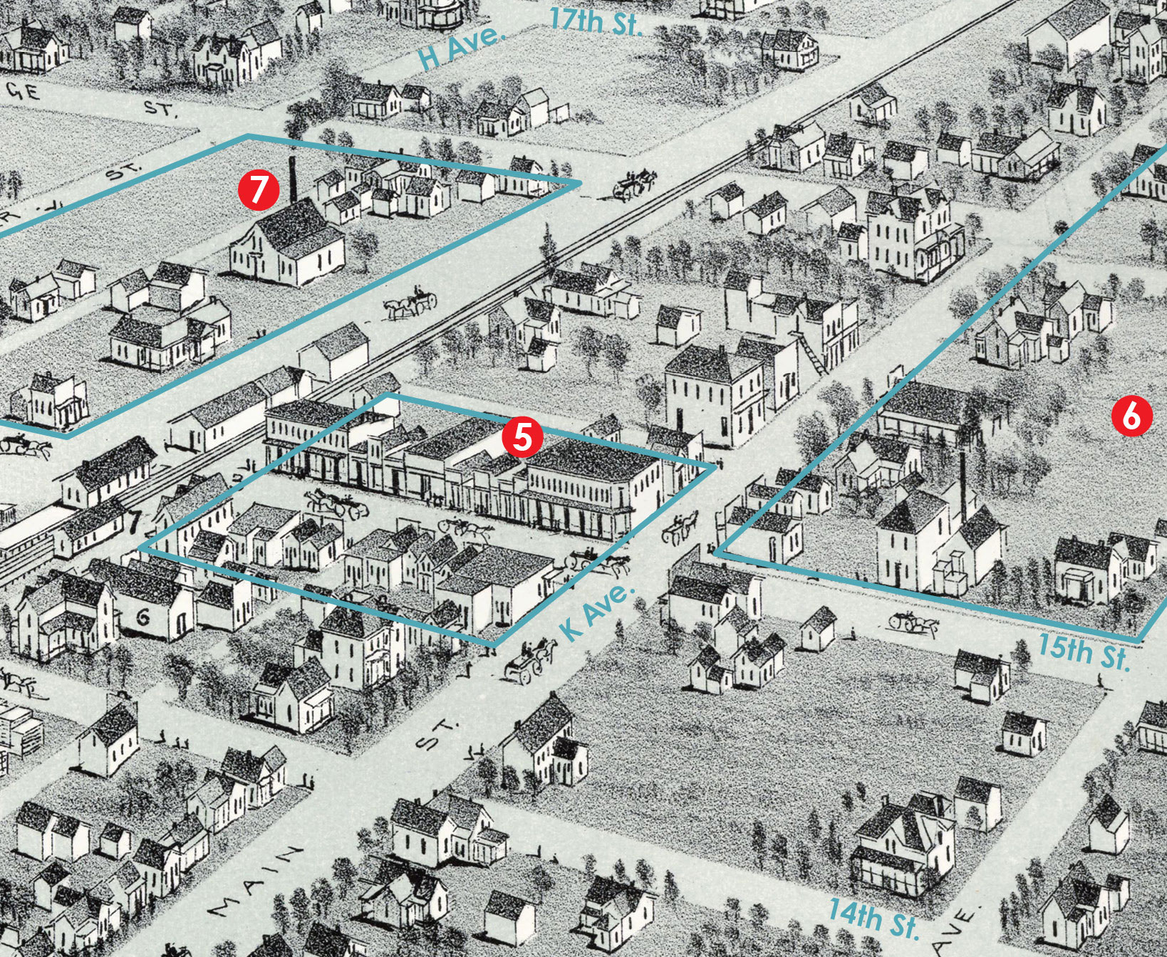
6. Municipal Center
Now home to Plano’s Municipal Center, the area northeast of present-day 15 Street and K was home to Beatty’s Cotton Gin, Blalack’s Livery and a boots and dry goods store.
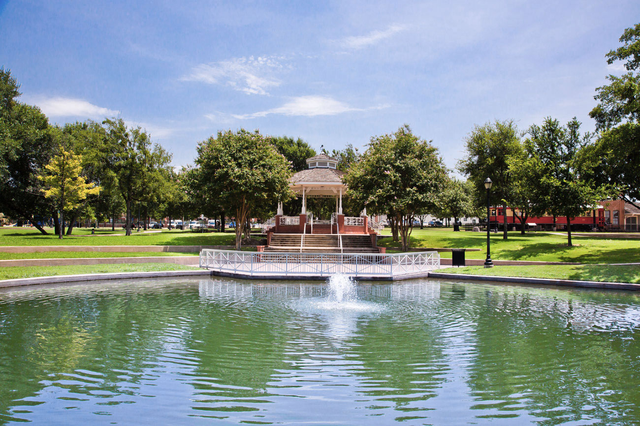
7. Haggard Park
In 1891, Saigling’s mill was located on the site of present-day Haggard Park. The Park was originally dedicated in 1925 and then expanded in the mid-1980s to its modern-day boundary (indicated by a green outline), which includes the Saigling House at the corner of 16th and H that the City of Plano is currently restoring.
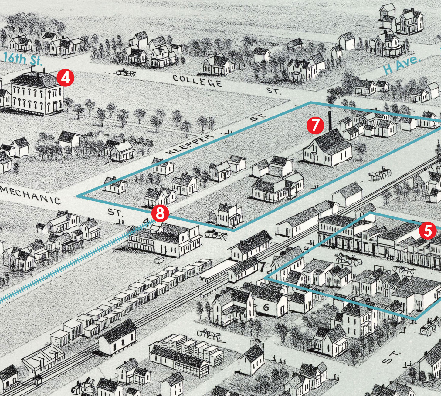
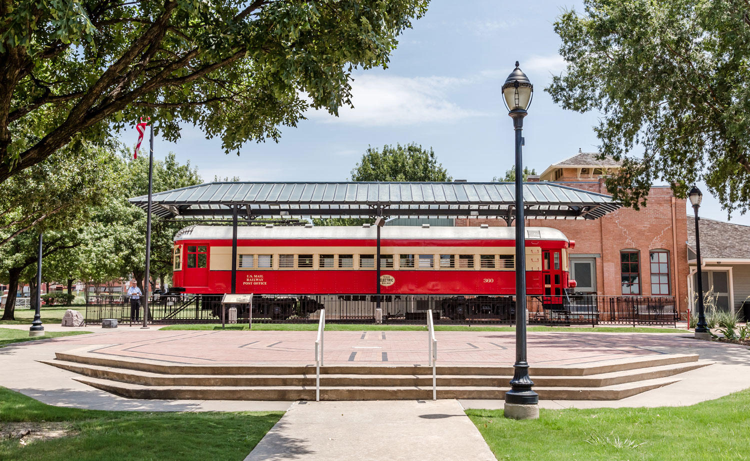
8. Interurban Railway
The Dallas-Sherman Interurban Railway began commuting passengers in July 1908 (indicated by the dashed line along present-day I Avenue). The tracks were laid parallel to the H&TC Railroad (now DART). The Interurban ceased operation in 1948 but the remaining depot still stands as the Interurban Railway Museum.
9. H&TC Railroad
The arrival of the Houston & Texas Central Railroad in 1872 linked Plano to McKinney and Dallas, and also solidified the nearby area on Mechanic Street (presently historic downtown) as the city’s business center. The modern-day DART tracks are laid over its path.
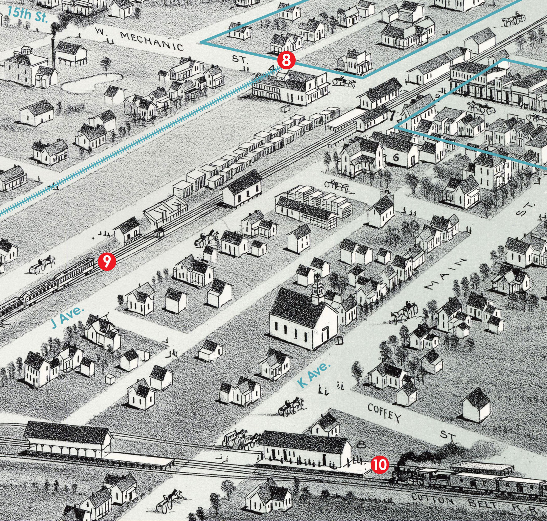
10. Cotton Belt Railroad
The St. Louis, Arkansas and Texas Railway Company built this railroad in 1887 to transport cotton from Texas to St. Louis, which led citizens to dub it the “Cotton Belt Railroad.” The fact that the two railroads intersected most likely contriuted to Plano’s rapid growth in both population and size.
MAP: Thaddeus Mortimer Fowler (1842–1922). Plano, Collin County, Texas, 1891, toned lithograph, 12.8 x 22.6 in., by A. E. Downs, Boston, published by T. M. Fowler & James B. Moyer, Amon Carter Museum of American Art, Fort Worth, Texas


Wonderful article. Thank you John!
My husband grew up in Plano. He’s only in his upper 40’s but remembers when most of it was undeveloped. He loved this article. Great job!
Hi John! Great article and I follow your posts on Facebook. I moved here from California in 1989 and bought my first home just South of Independence and Parker. From there I had a house built in Deerfield and currently live near Bethany Elementary (closer to Hedgecoxe). I have been fascinated by Plano from day 1! Man have I seen it change in the relatively short time I’ve been here! My wife and I still walk the downtown streets whenever we can. Thanks again for your informative articles and posts!
I’ve been enjoying looking at John’s Facebook pages about Plano and its history.
I grew up starting after the 3rd grade at 214 College, which became 811 16th Street in the 1940’s to assist the arrival of U.S. mail delivery in Plano. Before that, we had to rent a box at the post office in downtown Plano, or use the general delivery window, which involved waiting in line at busy times, to receive our mail. I appreciate all the work folks have done in digging out historic photos and maps for these pages. I particularly appreciated when a building’s street address is used with the picture so that I can have another look at the surviving buildings.
trying to find the name of the saloon on 1010 Mechanic St. (now 15th St) that was the only building in 1895 that didn’t burn…