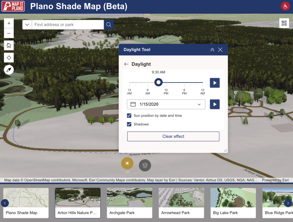
The City of Plano launched an interactive map this week that shows sunlight and shade patterns across the city’s parks to help residents plan visits around shaded areas.
“This tool helps residents take the guesswork out of planning a park visit,” Parks and Recreation Assistant Director Dave Angeles said. “By showing how shade moves throughout the day, it gives people the ability to choose the time and place that works best for them.”
The idea for the map came from a comment on social media asking when the best time to visit parks would be based on shade. From there, staff began utilizing existing data from the City’s 2023 Urban Forestry tree inventory to create the map alongside Parks and Recreation, Planning, GIS and Urban Forestry teams.
All users have to do is select a park, choose a date and time and use a slider to see how sunlight and shade shift across the landscape.
A press release notes that the map is still in its beta phase, and park features like playgrounds might not reflect real-world conditions. The tool will continue to evolve as more data is collected.
The shade map can be viewed online on both desktop and mobile.